top of page

All Posts

Code for Emergency 1st Place
PupilPulse | USA Every six seconds, someone dies from diabetes, yet over 252 million people worldwide are currently living with the condition completely undiagnosed. Left undetected, undiagnosed diabetes frequently leads to severe nerve damage, autonomic neuropathy, and life-threatening medical emergencies. PupilPulse addresses this critical screening gap through an affordable, non-invasive medical device aligned with UN SDG 3 (Good Health and Well-being) and SDG 10 (Reduced
Lauren Ouyang
Oct 271 min read

Code for Emergency 2nd Place
AZ EZ | USA AZ EZ is an emergency accessibility app inspired by Arizona, where a large rural population can face barriers to accessing critical information during emergencies. It uses live emergency data and AI to make alerts easier to understand based on each person’s needs and situation. Our goal is to make sure all people can access emergency information they can understand and act on when it matters most because everyone deserves access to emergency information.
Lauren Ouyang
Oct 271 min read

Code for Emergency 3rd Place
RapidAid | Cameroon RapidAid is a mobile first-aid and emergency-response application designed to help people take the right action during medical emergencies, especially in situations where professional help may take time to arrive. The project is currently being developed as an MVP focused initially on Douala, Cameroon. The app is built around three main goals: providing fast access to first-aid procedures, making emergency services easier to contact, and ensuring essential
Lauren Ouyang
Oct 272 min read
Code for Agriculture 1st Place
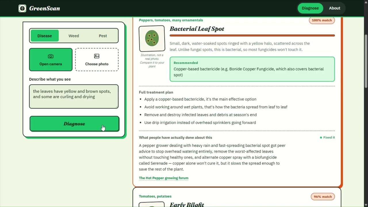
GreenScreen | Ethiopia Plant diseases, pests, and unwanted weeds can damage crops, compete for nutrients, reduce agricultural productivity, and cause significant losses, yet identifying these problems is not always easy for farmers, gardeners, and plant owners who may not have immediate access to agricultural experts. GreenScan is an AI-powered plant diagnosis and identification system designed to make identifying plant diseases, pests, and weeds faster, simpler, and more acc
Lauren Ouyang
Oct 272 min read
Code for Agriculture 2nd Place
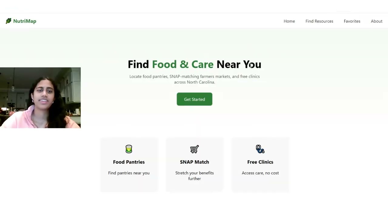
NutriMap | USA We want to help low-income families ensure proper nutrition by mapping free clinics where people can get the right nutritional advice and mapping locations where people can access fresh and affordable food. A core focus of our app is the SNAP Double Bucks program, which doubles EBT dollars at participating farmers markets. This does double duty: it helps SNAP recipients stretch their benefits further on fresh produce, and it redirects that spending into local f
Lauren Ouyang
Oct 271 min read

Code for Agriculture 3rd Place
HarvestRelay | USA HarvestRelay is a resilience platform for small farms and agricultural cooperatives. It helps recover a harvest when the planned buyer, route, vehicle, or storage suddenly becomes unavailable.
Lauren Ouyang
Oct 271 min read


Code for Transportation 1st Place
Vihaan Joshi | USA Many wheelchair users, people with walkers, and the elderly cross at half the speed of normal walkers. The traffic light has no idea they are there. The lights countdown to hand the road back to the traffic. Yet, according to studies, pedestrians over the age of 65 are twice as likely to be killed per crossing as those who are younger. The pedestrian button also does not help the traffic light as it only indicates that somebody is over there waiting, not fo
Lauren Ouyang
Aug 302 min read

Code for Transportation 2nd Place
BuzzTeam | USA When a crash, snow, or sudden failure knocks out a bus or train line, transit agencies come up with inefficient detours, causing riders to lose access to clinics, schools, and grocery stores. This affects everyone, but especially older people, students, and riders with disabilities who depend on a single transit line to stay connected to their daily life. LIFELINE is an interactive web application built on GTFS timetable data that lets anyone check a city's tra
Lauren Ouyang
Aug 302 min read


Code for Transportation 3rd Place
Safe Routes | USA Between 2020 and 2024, 1,838 children aged 10 to 18 were robbed on the streets of Los Angeles, and 1,026 of those robberies happened during school commute hours. That is 56% of them inside five hours of the day, on blocks the city already publishes in its open data. No map app routes around them. Ours does. You pick a school, type your address, and get three routes with the reasoning written out: skips 552 m of South Fairfax Avenue, which scores 65 at this h
Lauren Ouyang
Aug 302 min read
Code for Environment 1st Place
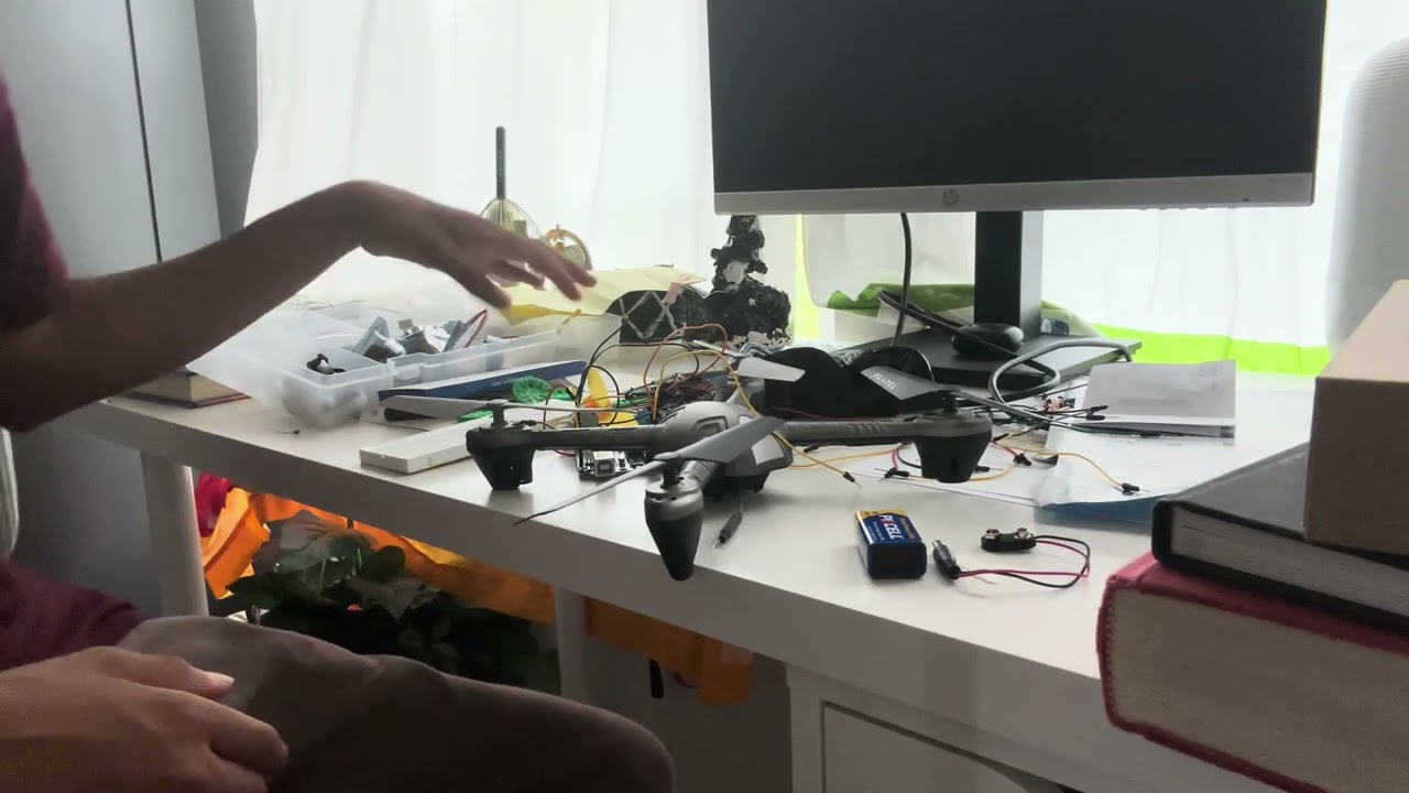
DroneX | USA Wildfires and other pollution events can make the air dangerous, but air quality data is often difficult to visualize and act on. We wanted to create a system that could turn invisible pollution into something people can understand and respond to. DroneX combines air-quality data, interactive mapping, and autonomous drone technology to monitor and visualize pollution. Users can identify areas of concern and use the system to plan and respond to changing air condi
Lauren Ouyang
Aug 102 min read


Code for Environment 2nd Place
Ayvian Earth | USA CanopyRx is built around a simple problem: cities often plant trees where projects are easiest to complete, not where canopy would do the most good. Our program turns that uneven decision-making process into a transparent, adjustable planning tool. Using neighborhood-level data from the U.S. Census and NYC Open Data, CanopyRx evaluates four conditions: heat vulnerability, community vulnerability, flood exposure, and school access. Users can change the weigh
Lauren Ouyang
Aug 102 min read


Code for Environment 3rd Place
Synergy | India GREEN PULSE is a web-based environmental health platform that helps users understand the ecological condition of a city through one simple Green Health Score. The score combines air quality, tree canopy, biodiversity, green space access, traffic pressure, and climate stress into a clear 0–100 rating. The app supports UN SDG 11, SDG 13, and SDG 15 by focusing on sustainable cities, climate action, and life on land. Users can switch between multiple global citie
Lauren Ouyang
Aug 101 min read


Code for Community 1st Place
KnightsCoders | USA Detour is a pedestrian navigation application that helps people find safer walking/travel routes through cities instead of simply the fastest ones. Using a custom-modified A* pathfinding algorithm, Detour assigns every street segment a dynamic risk score based on real crime incident data, street lighting, proximity to safe locations such as police stations or hospitals, time of day, and anonymous community safety reports. Rather than providing only the sho
Lauren Ouyang
Jul 61 min read


Code for Community 2nd Place
VeteranConnect | USA VetConnect is a mobile app built to bridge the gap between veteran-owned businesses and the communities that genuinely want to support them. We give veterans a platform to register and showcase what they’ve built, while everyday consumers (both veterans and civilians) can discover and engage these businesses in ways that actually matter and for services and products they are seeking anyways. VetConnect is designed around interactivity and user engagement
Lauren Ouyang
Jul 61 min read


Code for Community 3rd Place
Pathlight | USA Pathlight is a cultural/language co-pilot for international students who are navigating life in a new country. Relocation to a new country for education often comes with a myriad of challenges, whether that be with unfamiliar banking, healthcare practices, or social norms as a whole. Pathlight aims to mitigate these challenges by offering a personalized "Day 1 to Day 90+" roadmap for students, covering all aspects of their new lives and allowing them to seamle
Lauren Ouyang
Jul 61 min read


Code for Education 1st Place
InSight | USA InSight is a Braille reading tracking device that provides data-driven insights to teachers of the visually impaired. Using a phone camera, InSight measures student reading speed in characters per second and minute, detects re-reads (or regressions), and identifies skipped or unread sections of text. InSight provides a way for teachers to pinpoint specific struggle areas and recognize patterns in student reading behavior that are difficult to observe. It does th

Vivian Li
Jun 21 min read


Code for Education 2nd Place
Feedback Loop | USA My project, the Feedback Loop, addresses the fears of public speaking, a problem present for many students and even adults. My program uses VR technology so users can record themselves giving a presentation in a classroom. The program transcribes and grades with the use of ai. The first important system is the whisper ai feature, which uses ai to convert the user’s speech into text. Next, the chatbot grading feature, analyses the transcript to output a let
Vivian Li
Jun 21 min read


Code for Education 3rd Place
Maker | Nepal Maker-base is an open-source, web platform that empowers makers, developers, and learners to document what they know and share it with the world. By giving anyone the ability to write notes and post content to the public, Maker Base allows individual learning to become a global, free resource. Someone solving a coding problem or fixing a broken SPI communication can share their solution, and someone in Brazil can learn from it instantly! How cool is that? Maker
Vivian Li
Jun 21 min read


Code for Cities 1st Place
EconEngineers | USA Cities rely heavily on residents to report broken sidewalks, unsafe curb ramps, and dangerous crosswalks, but most reports are handled in a first-come, first-served way. This often means that highly dangerous issues, especially those affecting elderly people, wheelchair users, and children, are not fixed as quickly as they should be. StepSafe is a lightweight web application that improves how cities manage pedestrian infrastructure issues. Residents can su
Vivian Li
Feb 11 min read

Code for Cities 2nd Place
EsDeeKoders | USA Our project entails the solution of smart traffic lights to mitigate traffic congestion. We solve global SDG issues 11, 9, 3, 13, 8, and indirectly solve 16 and 10. By implementing this solution, not only do we lessen risks of traffic accidents and crashes, but we help the environment around us by stabilizing greenhouse gasses and emissions into the atmosphere, help people reach their destinations faster with efficiency, and help pedestrians walk across cros
Vivian Li
Feb 11 min read
bottom of page